")
A competent set of surveys (with work experience in similar projects) is required. The use of appropriate monitoring methods based on the dimensions of the project (free station, microgeodesy and instrumentation) is mandatory. Calibration and accuracy of cameras is very important. Controlling the project area and adjusting the position of piles and solders (without hitting the columns of the main structure) are the tasks of the surveyor. The main monitoring is recommended in a separate set from the contractor (under the supervision of the employer), especially in large excavation. The surveyor should install the behavioral benchmarks outside the excavation walls in a fixed location that is not affected by the displacement of the excavation walls. The lowest level of the structure (the place where the structure contacts with the soil) is the place of installation of reflectors to control the amount of displacement of the tip of the excavation wall. Tapes should be labeled and protected in such a way that they do not disappear with the shotcrete and maintain their efficiency. In low-altitude excavations, the point coordinate system can be used in each period. In medium-height excavations, it is necessary to use the advanced method of open or close 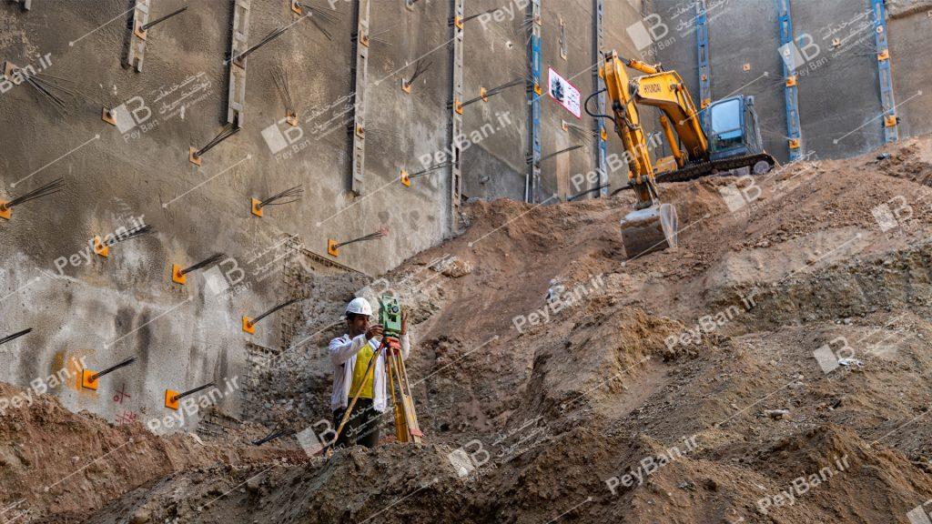 traverse and dividing the traverse error and assigning the divided coordinates to the benchmarks.
At present, unfortunately, accurate mapping methods such as microgeodesy are less commonly used to monitor the walls of the excavation, or traditional methods use cameras that are not calibrated or have a large default error. Their information is practically not used for geotechnical purposes.
In high-altitude excavations, the microgeodizing method, which has the lowest error in mapping, should be used. In this method, benchmarks are constructed in the form of pillars around the project. Another method of controlling excavation behavior in large projects is the use of precision instruments such as strain gauges, inclinometer, dynamometers, gradimeter etc. The monitoring intervals of the excavation walls vary according to the conditions and sensitivity of the project, the amount of deformations, the increase of the excavation depth, and so on.
It is necessary for the surveyor to provide suitable graphs of horizontal and vertical deformations to the employer, designer, resident supervisor and supervisor of the engineering system, and only the presentation of deformation values is not appropriate and the deformation process should also be examined. Comparison of deformations with computational values by the designer in large excavation is mandatory. The location plan of the reflectors (horizontal and vertical distances based on the type and sensitivity of the overhead, repetition in the walls of multi-storey  buildings to control the rotation of the structure, etc.) should be done by the surveyor with the opinion of the designer and project supervisor.